Showing posts with label Central. Show all posts

Uthai Thani is an island located of Thailand

Uthai Thani

Uthai Thani is an island located of Thailand

Uthai Thani is a province abundant in natural resources, such as forests and wildlife. “Huai Kha Khaeng Wildlife Reserve” here was proclaimed a Nautral World Heritage Site on 13 December 1991. The reserve has jungles, forests, plains, many streams, and most importantly, a number of rare and endangered animals.

Due to the verdant nature of the area, Uthai Thani is a province with unspoiled natural tourist destinations that are of interest to tourist everywhere.

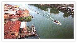
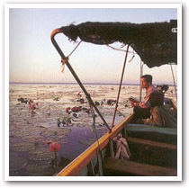
Furthermore, visitors can see the different lifestyles of locals, such as the life of raft residents on Sakae Krang River, a waterway that aided the birth of the province and which has been a lifeline for its people since ancient times. It is also where provincial trading has flourished. Life revolving around the river eventually grew from a community into the major province that it is today.

Uthai Thani is an island located of Thailand

The most striking indication of the bond between the people and the river since the old days is that in 1906, when King Rama V visited northern provinces and stayed in Sakae Krang village, the monk Phra Khru Uthai Tham Nithet (Chan) built 2 twin rafts to receive the king. This clearly showed the importance of the river and the lifestyle of the people living off it in that period.

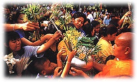
In addition, at the end of the Buddhist Lent, Buddhists from all directions congregate in the province for a major merit-making tradition called Tak Bat Thewo at the foot of Khao Sakae Krang at Wat Sangkat Rattana Khiri. This festival has been held in Uthai Thani since ancient times.

Uthai Thani is an island located of Thailand

Uthai Thani is located in the lower part of northern Thailand. Most of the province consists of forests and high mountains. It has a total area of 6,730 square kilometres. It is divided in to 8 Amphoe (districts), as follows: Amphoe Muang Uthai Thani, Amphoe Lan Sak, Amphoe Nong Kha Yang, Amphoe Nong Chang, Amphoe Thap Than, Amphoe Ban Rai, Amphoe Sawang Arom and Amphoe Huai Khot

Read More...

Suphan Buri in Thailand

Suphan Buri

Suphan Buri in Thailand

Just a hundred kilometres away from Bangkok, Suphan Buri is an ancient town rich in natural and historical heritage. The province was once an important border town involving battles and important wars during the period of the Ayutthaya kingdom.  So, today, travelling around the province is like drifting through historical novels.  Historical evidence leads you to travel to the past such as Don Chedi Monument, Wat Khao Khuen whose abbot played a significant role in Thai history, U Thong National Museum, etc.  Furthermore, various natural wonders such as Phu Toei National Park, Bueng Chawak Aquarium, as well as the famous local-style cake Sali Suphan always impress visitors.

Suphan Buri occupies a total area of 5,358 square kilometres and is administratively divided into 10 districts (Amphoes); Muang Suphan Buri, Doem Bang Nang Buat, Bang Pla Ma, Si Prachan, Song Phi Nong, Sam Chuk, U Thong, Don Chedi, Dan Chang and Nong Ya Sai.

Read More...

Sing Buri in Thailand

Sing Buri

Sing Buri in Thailand

Sing Buri is 142 kms. north of Bangkok on the west bank of the Chao Phraya River. It was established in the year 1895 during the reign of King Rama V through a consolidation of three small riverside towns including Sing Buri, In Buri, and Phrom Buri. The province currently occupies an area of 822 square kilometres and is divided into six districts (Amphoes): Muang Sing Buri, In Buri, Bang Rachan, Khai Bang Rachan, Phrom Buri and Tha Chang.

Read More...

Saraburi is an island located of Thailand

Saraburi

Saraburi is an island located of Thailand

Saraburi, the province of historical sites, the holy footprint, the beauty of nature, and famous food, is located some 108 kilometres from Bangkok. Travelling to and around Saraburi could be made in one day. The province is administratively divided into 13 districts: Muang Saraburi, Nong Saeng, Sao Hai, Ban Mo, Phra Phutthabat, Nong Don, Kaeng Khoi, Muak Lek, Wang Muang, Wihan Daeng, Nong Khae, Don Phut, and Chaloem Phra Kiat.

Read More...

Samut Songkhram is an island located of Thailand

Samut Songkhram

Samut Songkhram is an island located of Thailand

Samut Songkhram is the province of fertile land, of plants and food grains, the production source of vegetables and fruits, as well as a vast variety of seafood products. It is also an interesting historical source for the early Rattanakosin period.

Samut Songkhram is an ancient province with a long history. Originally, it is believed that this province was once a part of Ratchaburi province, and called Suan Nork at that time. Then, towards the end of the Ayutthaya period going on to the Thonburi period, it was separated from Ratchaburi province and was called Mueang Mae Klong.

Samut Songkhram is located 72 Kilometres from Bangkok, occupies an area of 416 square kilometres and is administratively divided into 3 districts: Amphoe Muang, Amphoe Amphawa, and Amphoe Bang Khonthi

Read More...

Samut Sakhon is an island located of Thailand

Samut Sakhon

Samut Sakhon is an island located of Thailand

Samut Sakhon was formerly called Tha Chin probably because, in the old days, it had been a trading port dealing with a vast number of Chinese junks. In 1548, a town named Sakhon Buri was established at the mouth of the Tha Chin River. It was a centre for recruiting troops from various seaside towns. The name of the town was changed into "Mahachai" when Khlong (canal) Mahachai was dug in 1704 to join the Tha Chin River at the town. Later, the town was renamed Samut Sakhon by King Rama IV but it is still popularly called "Mahachai" by the villagers.

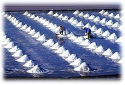
Samut Sakhon is located 30 kms. from Bangkok. The province occupies a total area of 872 square kilometres and is administratively divided into 3 districts: Muang Samut Sakhon, Krathum Baen, and Ban Phaeo. It is a major fishing port and also the biggest producer of brine salt.

Read More...

Samut Prakan is an island located of Thailand

Samut Prakan

is an island located of thailand

Samut Prakan, also known as Pak Nam, is located 29 kilometres south of Bangkok, around the area where the Chao Phraya River flows into the Gulf of Thailand. It is a town of the Ayutthaya period. Samut Prakan is home to countless historical and cultural sites. It occupies an area of 1,004 square kilometres and is administratively divided into 5 districts (Amphoes) and 1 sub-district (Ging Amphoe); Amphoe Muang Samut Prakan, Amphoe Phra Pradaeng, Amphoe Bang Phli, Amphoe Bang Bo, Amphoe Phra Sumut Chedi, and Ging Amphoe Bang Sao Thong.

Read More...

Phichit island in Thailand

Phichit

Phichit is an island located Central of Best Tour Thailand Travel

Situated in the Lower North some 345 kilometres from Bangkok, Pichit is accessible by both road and rail. Nurtured by two rivers, the Yom and the Nan running parallel to one another north to south, the land is agriculturally fertile. Once the site of an ancient town dating back almost a thousand years ago, Phichit has played in a major role in the history of both Sukhothai and Ayutthaya.

Phichit is an island located Central of Best Tour Thailand Travel

Known as the land of the crocodiles, it has been home to this ferocious reptile which has thrived in its waters. There are today several fresh-water crocodile farms. Phichit features in the Thai epic Krai Thong composed by King Rama II which tells of Chalawa

Phichit is administratively divided into the following districts: Muang, Pho Prathap Chang, Taphan hin, Bang Mun Nak, Pho Thale, Sam Ngam, Wang Sai Phun, Thap Khlo, Sak Lek, Dong Charoen, Bueng Na Rang and Wachirabarami

Read More...

Phetchabun island in Thailand

Phetchabun

Phetchabun is an island located Central of Best Tour Thailand Travel

346 kilometres from Bangkok, Phetchabun borders on three regions, the North, the Central and the Northeast. The central part of the province is on the Pa Sak river basin with mountain ranges running along both the western and eastern sectors. Because of the fertility of the land, Phetchabun has always been an agriculturally productive area. The very name of the province actually means the land of crops and foods.

Today, Phetchabun is a province with rich tourism potential. Its climate is pleasant due to the mountainous and forested areas and it has a history of richness and prosperity for more than 1,400 years. As and Sukhothai styles have been discovered.

Phetchabun is administratively divided into the following districts: Muang, Lom Sak, Lom Kao, Chon Daen, Nong Phai, Wichian Buri, Si Thep, Bueng Sam Phan, Wang Pong, Nam Nao and Khao Kho.

Phetchabun is an island located Central of Best Tour Thailand Travel

 Phetchabun is an island located Central of Best Tour Thailand Travel

Read More...

Pathum Thani Island in Thailand

Pathum Thani

Pathum Thani Island in Thailand

Pathum Thani is a neighbouring province of Bangkok. It is situated on the Chao Phraya basin with plenty of canals and orange plantations. Its original name is Mueang Sam Khok, which was founded during the Ayutthaya era. It was the settlement for the Mon people migrating from Mohtama (in Myanmar) over 350 years ago. In the year 1815 when King Rama II made a royal visit to this area, the inhabitants offered him plenty of lotus flowers which is the origin of the present name.

The Pathum Thani Town is only 46 kms. from Bangkok. It occupies an area of 1,525 square kilometres and is administratively divided into 7 districts (Amphoes): Muang Pathum Thani, Lat Lum Kaeo, Sam Khok, Thanyaburi, Nong Suea, Khlong Luang, and Lam Luk Ka.

Read More...

Nonthaburi island in Thailand

Nonthaburi

Nonthaburi is over 400 years old, dating back to when Ayutthaya was the capital. The town was originally located at Tambon Ban Talat Khwan, a famous fruit orchard where the Chao Phraya River and various canals pass through.

King Prasat Thong ordered the digging of a canal as a shortcut from the south of Wat Thai Muang to Wat Khema because the old waterway flowed into Om River to Bang Yai then to Bang Kruai Canal next to Wat Chalo before ending in front of Wat Khema.

After the new shortcut was completed, the Chao Phraya River changed its flow into the new route that remains today. In 1665, King Narai the Great noticed that the new route gave enemies too much proximity to the capital. Therefore, he ordered that a fortress be built at the mouth of Om River and relocated Nonthaburi to this area. A city shrine still stands there.

Later during the reign of King Rama IV of the Rattanakosin period, he ordered the town moved to the mouth of Bang Su Canal in Ban Talat Khwan. King Rama V then had the provincial hall built there on the left bank of the Chao Phraya River. In 1928, the hall was moved to Ratchawitthayalai, Ban Bang Khwan, Tambon Bang Tanao Si. It is now the Training Division of the Ministry of Interior on Pracha Rat 1 Road, Amphoe Muang, on the bank of the Chao Phraya River. The building is of European architecture decorated with patterned woodwork. The Fine Arts Department has registered it as an historical site. The provincial hall is now on Rattanathibet Road.

Read More...

Nakhon Sawan in Thailand

Nakhon Sawan

Nakhon Sawan in Thailand island

Nakhon Sawan Province, also known as Pak Nam Pho is where the rivers of Ping, Wang, Yom, and Nan converge and form the Chao Phraya River, the most important waterway of Thailand.

Nakhon Sawan is in the lower northern part of the country between the North and the Central Region. It is regarded as the doorway to the North and it is the hub of transportation in the Lower North.

Read More...

Nakhon Pathom in Thailand

Nakhon Pathom

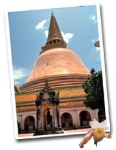
Nakhon Pathom is a small province located just 56 Kms. from Bangkok. The province features an ancient religious structure called “Phra Pathom Chedi”, the first religious landmark that signified the influx of Buddhism into Thailand. Nakhon Pathom is also renowned for its abundant fruits varieties and famous dishes.

Formerly situated by the sea, the city prospered during the Dvaravati civilisation. According to archaeological findings, Nakhon Pathom was the first city to possess influences of Buddhism and Indian civilisations. From the Phra Pathom Chedi and other remains discovered in the city area, it is believed that the city was a centre of civilisation in that era. People of different races settled in Nakhon Pathom. However, a change in the course of the river caused a draught that forced the people to migrate and settle on the banks of river, and these communities developed into towns. The new town was called “Nakhon Chaisi” or “Sirichai”, leaving Nakhon Pathom deserted for hundreds of years until the reign of King Rama IV. While His Majesty was in monk hood, he travelled to Nakhon Pathom and found the Phra Pathom Chedi that he regarded to be the largest pagoda of all.

Nakhon Pathom island in thailand

When King Rama IV ascended to the throne, he commanded that a bell shaped Chedi be built to cover the former Chedi. The surrounding area was also renovated and improved. He also commanded that a water canal be dug to facilitate commuting, which was called Chedi Bucha canal. During the reign of King Rama V, the construction of railways to the south began, at that time Nakhon Pathom was still a heavily forested area. King Rama V also commanded that the town be relocated from Tambon Thana, Amphoe Nakhon Chaisi, to the Phra Pathom Chedi area as it used to be. Nakhon Pathom has been there ever since.

During the reign of King Rama VI, a palace was built at Tambon Sanam Chan as a temporary residence on his travels and many roads were constructed. A large bridge was also built over the Chedi Bucha canal, which His Majesty named “Saphan Charoensattha”. Later, he commanded that the name of Nakhon Chaisi be changed to Nakhon Pathom, but the name of the prefecture was still called “Nakhon Chaisi” until the reign of King Rama VII when the calling of the prefecture was ended. Nakhon Chaisi is now one of the districts in Nakhon Pathom.

Nakhon Pathom island in thailand

Nakhon Pathom covers an area of 2,168 square kilometres or 542,081.6 acres. It is divided into 7 administrative districts or Amphoe, they are: Amphoe Muang Nakhon Pathom, Amphoe Buddhamonthon, Amphoe Sam Phran, Amphoe Nakhon Chaisi, Amphoe Bang Len, Amphoe Kamphaeng Saen, and Amphoe Don Toom. Most of the areas are plains with no mountainous land, plateau are found in the west east of Amphoe Muang and Amphoe Kamphaeng Saen. The plains along the Tha Cheen River (Nakhon Chaisi River) are the location of Amphoe Nakhon Chaisi, Amphoe Sam Phran, and Amphoe Bang Len. These fertile lands provide agricultural area for people, thus most of the residents earn their living from agriculture; plantations, farming, growing food crops, and fruit orchards. Moreover, Nakhon Pathom is well known for pomelo, some call the Nakhon Pathom the sweet pomelo town.

Read More...

Nakhon Nayok in Thailand

Nakhon Nayok

nakhonnayok_01

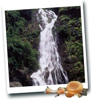
Nakhon Nayok is a destination which is often taken for granted by many tourists. The fact that it is located just 106 kilometers from Bangkok and its attractions may be visited as a day trip makes it just a stop over spot for travelers. But this is not always the case. Nakhon Nayok is famous for its refreshing natural beauty including waterfalls and parks, renowned historical sites, soft adventure activities, and its variety of fruits.

Nakhon Nayok is one of Thailand's central provinces. Covering some 2,130 square kilometres, it borders Saraburi and Nakhon Ratchasima Provinces on the north, Prachin Buri Province on the east, Chachoengsao Province on the south and Pathum Thani Province on the west.

The northern part of Nakhon Nayok is located in the Dong Phaya Yen mountain range an area covered by the Khao Yai National Park. Yod Khao Kiew, its highest peak, is 1,292 meters above sea level. The central part of the province is on a contrary, a rather flat river plain formed by the Maenam Nakhon Nayok. The southern part of the province has relatively unfertile acidic soil.

nakhonnayok_02

The provincial seal says a lot about Nakhon Nayok. It is a picture of a circle indicating the unity of Nakhon Nayok people. An elephant raising an ear of rice in the circle represents fertile forests with numerous elephants. An ear of rice refers to farming which is fruitful. The background with a pile of straw, trees and clouds depicts fertility and the natural beauty of the province.

Nakhon Nayok is a province with a history of over 900 years. It was believed to have been established in the Dvaravati period as indicated by some remains found in Ban Dong Lakhon, a village to the south of the town. During the Ayutthaya period and the reign of King U-Thong, the town which was an eastern garrison was only a forested but infertile highland called Ban Na (village of the rice field). Jungle fever, unfruitful and unproductive agriculture forced the settlers to migrate elsewhere. It was not until the King granted an exemption of paddy field tax that people began to move in and settle down as a community. It was then named Muang Nayok which literally means the town that the paddy tax was lifted.

In 1894, under the royal command of King Rama V, Nakhon Nayok was designated as part of Prachin Buri province. Eventually, it became a province in its own right.

Read More...

Lop Buri in Thailand

Lop Buri

lopburi_01

A province in the central region of Thailand, Lop Buri Province is located approximately 154 kilometers north of Bangkok. Covering an area of 6,199 square kilometers, the province is situated on the western end of the Khorat Plateau. It borders Chaiyaphum and Nakhon Ratchasima Provinces on the east, Phetchabun and Nakhon Sawan Provinces on the north, Sing Buri, Ang Thong, Ayutthaya and Saraburi Provinces on the South. Lop Buri Province is one of several provinces in central Thailand where many significant historical artifacts and prehistoric settlements have been discovered.

Formerly known as Lawo, Lop Buri had for centuries been ruled by several Kingdoms. The remains of Lop Buri, dating over 1,200 years attests to the strategic significance of Lop Buri to many rulers. These relics, ranging from the Bronze Age to the Ratanakosin period, have made Lop Buri a blend of east and west and ancient and modern, revealing the citys turbulent and alluring history and a glimpse of Thailands extraordinary past.

The Past

lopburi_02

Lop Buri was first developed into a major town during the Dvaravati Kingdom (6th 11th centuries). Most historians believed the first settlers of the town were the Lawa (an ethnic group related to the Mons) which is the reason for naming the town Lawo. In 10th century, the town came under absolute sovereignty of the Khmers who made it one of their oldest provincial capitals. The Khmer Mahayana Buddhism style was a major influence on the towns architecture and was later commonly referred to as Lop Buri Style. Remains of KhmerHindu architectural motifs found in the city include the Shivas Shrine (Prang Khaek), San Phra Kan, Phra Prang Sam Yot, and Wat Phra Si Mahathat.

It was in the late 13th century when the Thais, who migrated from the North, fought against the Khmers and declared their independence. Since then, Lop Buri has been ruled by Thai Kings.

Lop Buri first became known when King U-Tong, who established the Ayutthaya Kingdom, sent his son, Ramesuan the Crown Prince, to govern the city. The Prince commanded the building of moats, city walls and battlement towers.

Lop Buri reached its height in 1664 when King Narai the Great of Ayutthaya named Lop Buri the Kingdoms second capital, which came after a threat of invasion from Hollanders. King Narai the Great rebuilt Lop Buri with the help of French architects and ruled the Kingdom from there, instead of Ayutthaya., Thus the citys architecture mostly reflected a mixture of Thai and Western styles, which can be seen today in the remains of the Royal Palace, the Royal Reception House etc.

Lop Buri gradually faded from the political scene with the death of King Narai the Great. It, however, made a comeback approximately 200 years later when King Rama IV of the Ratanakosin Era decided to restore the city. He also commanded the restoration of the old Palace and named it Phra Narai Ratchaniwet (Narai Ratchaniwet Palace) in honor of King Narai the Great.

After Thailands democratic revolution, Marshall Poh Pibulsongkram rebuilt a military camp near the citys railroad, therefore, dividing the city into the old (ancient) and new zone.

The Present

lopburi_03

Today, Lop Buri is administratively divided into 11 Amphoes (Districts) including Muang, Ban Mi, Chai Badan, Khok Charoen, Khok Samrong, Phatthana Nikhom, Tha Luang, Tha Wung, Sa Bot, Lam Sonthi and Nong Muang.

Apart from historical attractions, Lop Buri provides opportunities for nature lovers to visit its famous Sap langka Wildlife Sanctuary in the north.

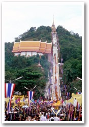
Another special landmark of Lop Buri is monkeys. To tourists, the city is known as the land of monkeys. To the people of Lop Buri, the monkeys are descendants of Hanuman who, according to the Ramayana, built Lop Buri as his kingdom. The food offerings in San Phra Kan drew the monkeys from nearby forests. These mischievous monkeys have taken over several attractions such as San Phra Kan and Phra Prang Sam Yot. A big feast for the monkeys on the last Sunday of November is held annually at Phra Prang Sam Yot and is one of the most attractive and most talked about tourist events in Thailand.
Read More...

Kamphaeng Phet

Kamphaeng Phet

kamphangphet_02

Geographically located in the Lower North on the bank of the Ping River, Kamphaeng Phet is 358 kilometres from Bangkok. To its East are riverine flatlands while the western areas are made up of high mountains lush with fertile forests where a number of national parks have been established.

kamphangphet_01

Areas along the river bank at present-day Mueang district used to host several ancient towns which had played a major role as strategic front-line frontiers since Sukhothai was the kingdom's capital down through the times of Ayutthaya and early Rattanakosin (Bangkok) eras. In fact, the name Kamphaeng Phet actually means as strong as walls or forts make of diamonds.

Kamphaeng Phet covers an area of 8,607 square kilometres. It is divided administratively into 9 districts, namely, Mueang Kampheang Phet, Phran Kratai, Khlong Khlung, Khanu Woralaksauri, Sai Ngam, Lan Krabue, Khlong Lan, Sai Thong Watthana and Pang Sila Thong and 2 sub-districts, Bueng Samakkhi and Kosamphi Nakhon.

Read More...

Chainat

Chainat

chainat_in_Thailand_Travel_Guide_Travel_Special_Thailand _Tour_Travel

Chainat is located on the east bank of the Chao Phraya River. The community was moved from the old site at Sankhaburi in the reign of King Rama IV. Chainat was an important town used several times as a base to confront the Burmese army. Every time, the Burmese were defeated, thus originating the name of Chainat which means a place of victory.

Chainat occupies an area of 2,469 square kilometres and is administratively divided into 6 districts: Amphoe Muang Chai Nat, Amphoe Hankha, Amphoe Manorom, Amphoe Sankhaburi, Amphoe Sapphaya, Amphoe Wat Sing, and 2 sub-districts: King Amphoe Nong Mamong and King Amphoe Noen Kham.

Read More...